
The Kronotsky Biosphere State Reserve, one of Russia’s oldest reserves, is located in the Kamchatka Territory. The reserve received state status in 1934.

The Kronotsky Biosphere State Reserve, one of Russia’s oldest reserves, is located in the Kamchatka Territory. The reserve received state status in 1934. Photo: Lake Geizernoye in Geyser Valley.

The reserve’s total area is 1,147,619.37 hectares.
Photo: Crater Lake of the Maly Semyachik Volcano.
Photo: Crater Lake of the Maly Semyachik Volcano.

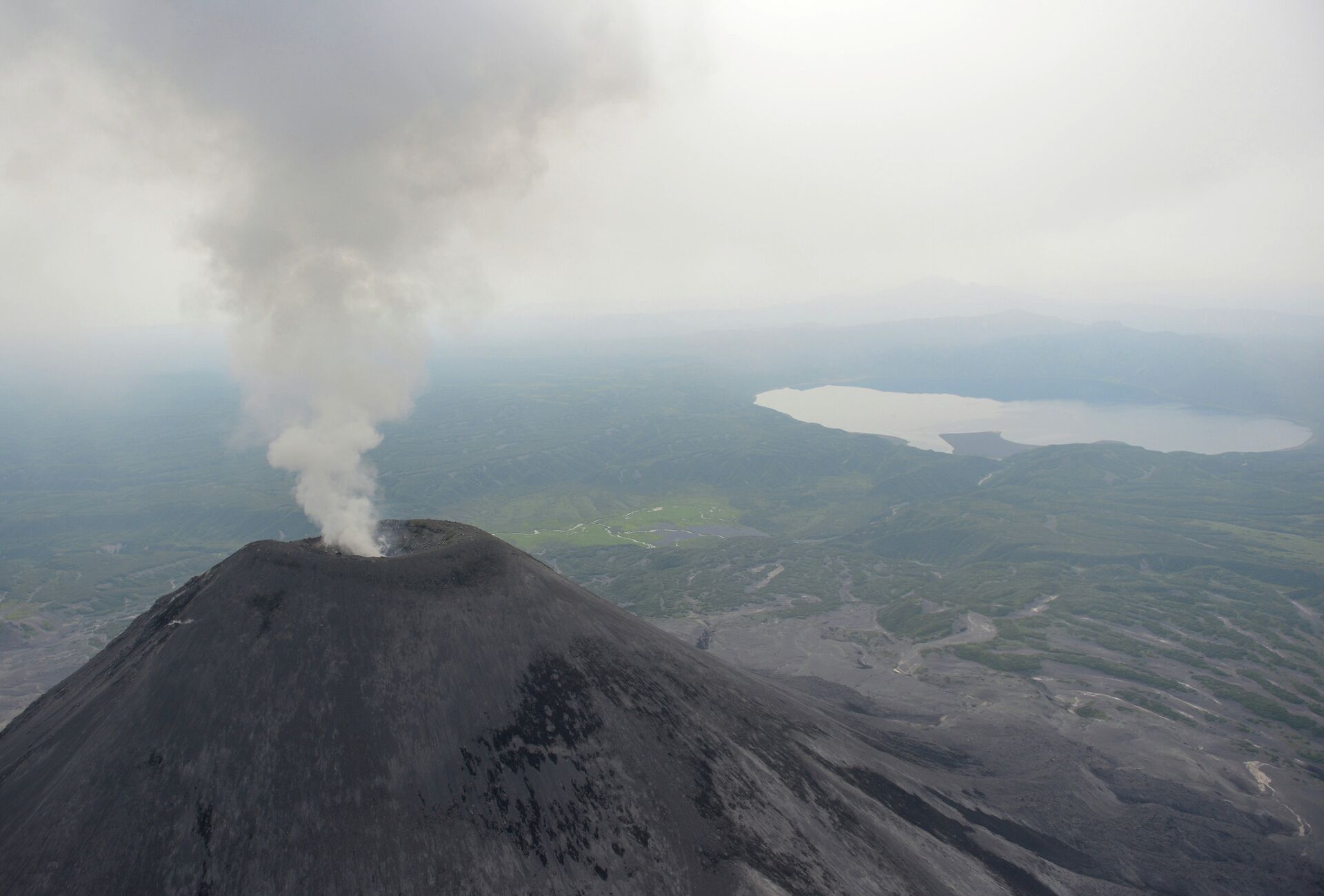
Eight active volcanoes are located in the reserve.

One can also find 35 waterfalls, thermal lakes and mud baths in the Kronotsky Reserve.
Photo: The Kosichka Waterfall in Geyser Valley.
Photo: The Kosichka Waterfall in Geyser Valley.

The famous Geyser Valley is also located here.
Photo: The Velikan (Giant) Geyser after erupting in Geyser Valley.
Photo: The Velikan (Giant) Geyser after erupting in Geyser Valley.

The Geyser Valley is, in fact, a canyon measuring up to four kilometers wide, 400 meters deep and eight kilometers long. The Geyzernaya River flows through it. Although there are dozens of similar canyons all over the Kamchatka Peninsula, more than 40 geysers and numerous thermal springs are located here six kilometers from the river’s source.
Photo: The Geizernaya River in Geyser Valley.
Photo: The Geizernaya River in Geyser Valley.

A geyser is a boiling water source, which regularly discharges a vapor-water mixture. Each geyser erupts at set intervals and has its own specific features.
Photo: The Bolshoi (Big) Geyser erupts.
Photo: The Bolshoi (Big) Geyser erupts.

In 2007, Geyser Valley was hit by a calamity caused by collapsing steep slopes. Waterfalls, as well as shifting and disintegrating ore segments, formed a complicated landslide accompanied by a mud-and-rock flow.
Photo: The Grozny mud baths in Geyser Valley.
Photo: The Grozny mud baths in Geyser Valley.

The landslide buried seven geysers. Many geysers were flooded, the Vorota (Gates) basalt cliffs were damaged, and the Geizernaya River changed its direction.
Photo: The Velikan (Giant) Geyser erupts.
Photo: The Velikan (Giant) Geyser erupts.

The Geyser Valley’s new landscape has become a unique proving ground for monitoring diverse types of terrain and for conducting other specialized research.

