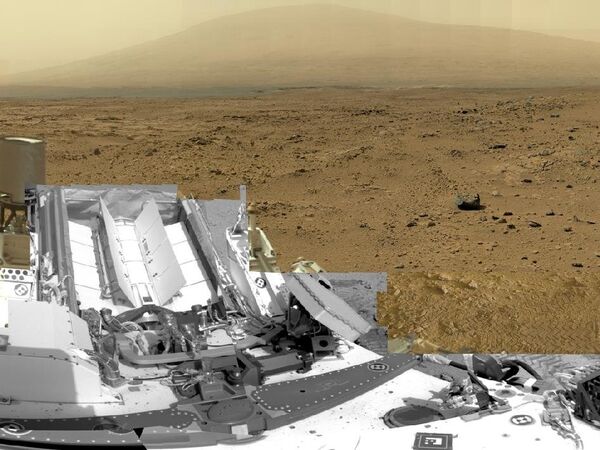
MOSCOW, June 20 (RIA Novosti) – NASA has compiled a 1.3-billion-pixel view of the surface of Mars based on some 900 photos taken by its Curiosity rover, the US space agency said Wednesday.
The scene surrounds the area where the rover collected its first samples of dusty sand at a patch called “Rocknest,” and extends to the colossal Mount Sharp.
“It gives a sense of place and really shows off the cameras' capabilities,” Bob Deen of the Multi-Mission Image Processing Laboratory at NASA's Jet Propulsion Laboratory in Pasadena, California, said in a press release.
“You can see the context and also zoom in to see very fine details,” said Deen, who stitched together 850 frames captured by the telephoto lens of Curiosity's Mast Camera, as well as 21 frames from the Mastcam's wider-angle camera and 25 black-and-white frames from the Navigation Camera.
Curiosity landed safely in the Gale Crater in August 2012 for a two-year mission to determine whether life exists or has existed on the Red Planet, and to study the climate and geology in order to prepare for future human exploration.
The probe is equipped for instruments for conducting detailed geological, geochemical, atmospheric and climatic research, including the detection of possible traces of water and organic compounds.
The panorama is available on NASA’s website: http://mars.nasa.gov/multimedia/interactives/billionpixel/index.cfm?image=PIA16919&view=cyl

