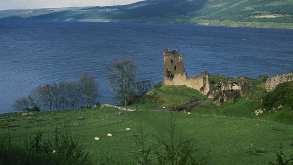
The search for the Loch Ness monster, first photographed in the 1930s, has been given a 21st-century helping hand by Google Maps, which on Monday released Street View imagery of the lake to its mapping service, allowing users to take part in the search from their computer.
The feature was created by a Google Street View camera, mounted on a boat and accompanied by marine biologist Adrian Shine, the leader of the Loch Ness & Morar Project and an expert on the lake, which is 23 miles [37 kilometres] in length and contains the greatest volume of freshwater in the British Isles, larger than all the lakes in England and Wales combined.
"It's the sort of place that, if there weren't any dragons, there really ought to be", said Shine in the course of the search, who has been researching the Scottish highlands since 1973.
The Google Maps imaging was released to mark the 81st anniversary of the 1934 'Surgeon's photo' of the monster, taken by Robert Wilson, who on April 14 was driving along the road close to the Loch when he noticed something moving in the water. Wilson, a surgeon, refused to link his name with the photo.
This day in 1934 the famous 'Surgeon's photo' of the Loch Ness Monster was published. Masthead posted without comment pic.twitter.com/KlpBmHO89V
— Ross McKay (@RossMc11) April 21, 2015
Wilson's image was published by the Daily Mail, who the year before had hired a well-known big-game hunter called Marmaduke Wetherell to hunt for the monster, after a previous, poorer-quality image taken by Hugh Gray on November 12, 1933, appeared to show a creature rising out of the water, the first known photograph. Gray's picture stirred modern interest in the monster, sightings of which date back to the sixth century.


