"By the end of 2018, another 18 satellites will be put into orbit for Beidou's navigation service," Ran Chengqi, spokesperson for the Beidou Navigation Satellite System, told Xinhua.
Ran explained that the positioning accuracy of the Beidou Navigation Satellite System inside China had reached five meters thanks to the development of the technology, including the improvement of a software algorithm.
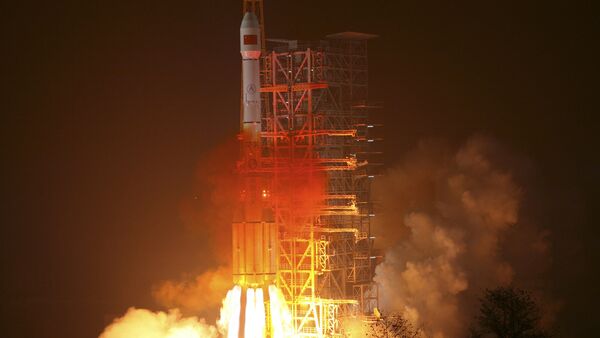
On February 1, China launched the latest addition to the Beidou Navigation Satellite System from the Xichang Satellite Launch Center in the southwestern province of Sichuan. It was carried into medium-earth orbit by the Long March 3C carrier rocket, where it was deployed at an altitude of about 13,670 miles (22,000 km), inclined 55 degrees.
"It is the 21st satellite in the Beidou Navigation Satellite System, and takes China one step closer to providing an alternative to the United States' GPS system," Xinhua reported.
The satellite was the fifth of a new generation of Beidou satellites, the first of which was launched in March 2015.
The system's first satellite, Beidou-1A, was launched on October 30, 2000, and formed an experimental Beidou navigation system when a third satellite was launched in 2003.
The five new generation satellites are tasked with "testing inter-satellite crosslinks and a new navigation-signaling system that will set the framework and technical standards for global coverage," Xinhua reported.
The New Silk Road Economic Belt aims to connect China with Central Asia and Western Asia, Russia and Europe, and the Maritime Silk Road will connect China with Southeast Asian countries, Africa and Europe.
In May 2015 China and Russia agreed a new stage of cooperation between China's Beidou system and Russia's Global Navigation Satellite System (Glonass). The agreement aims to strengthen the compatibility, interoperability and common development of the two systems to provide better and more reliable satellite navigation service.


