
Last year, NASA told us about Pluto’s “broken heart” region, claiming that the dwarf planet has its own “heart,” a mysterious surface area in the Tombaugh Region.
Pluto's water ice hills “float” in a sea of frozen nitrogen & move over time like icebergs: https://t.co/1hxl26xcAy pic.twitter.com/c5MCxO37wg
— NASA (@NASA) 4 февраля 2016

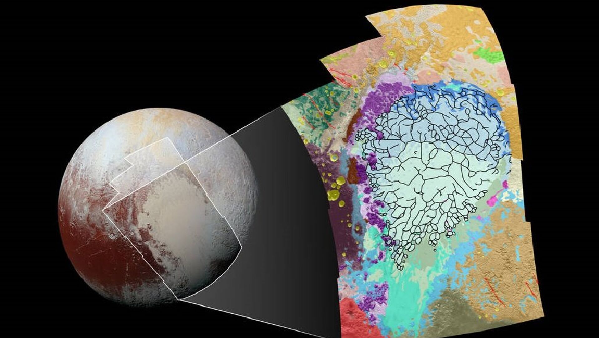
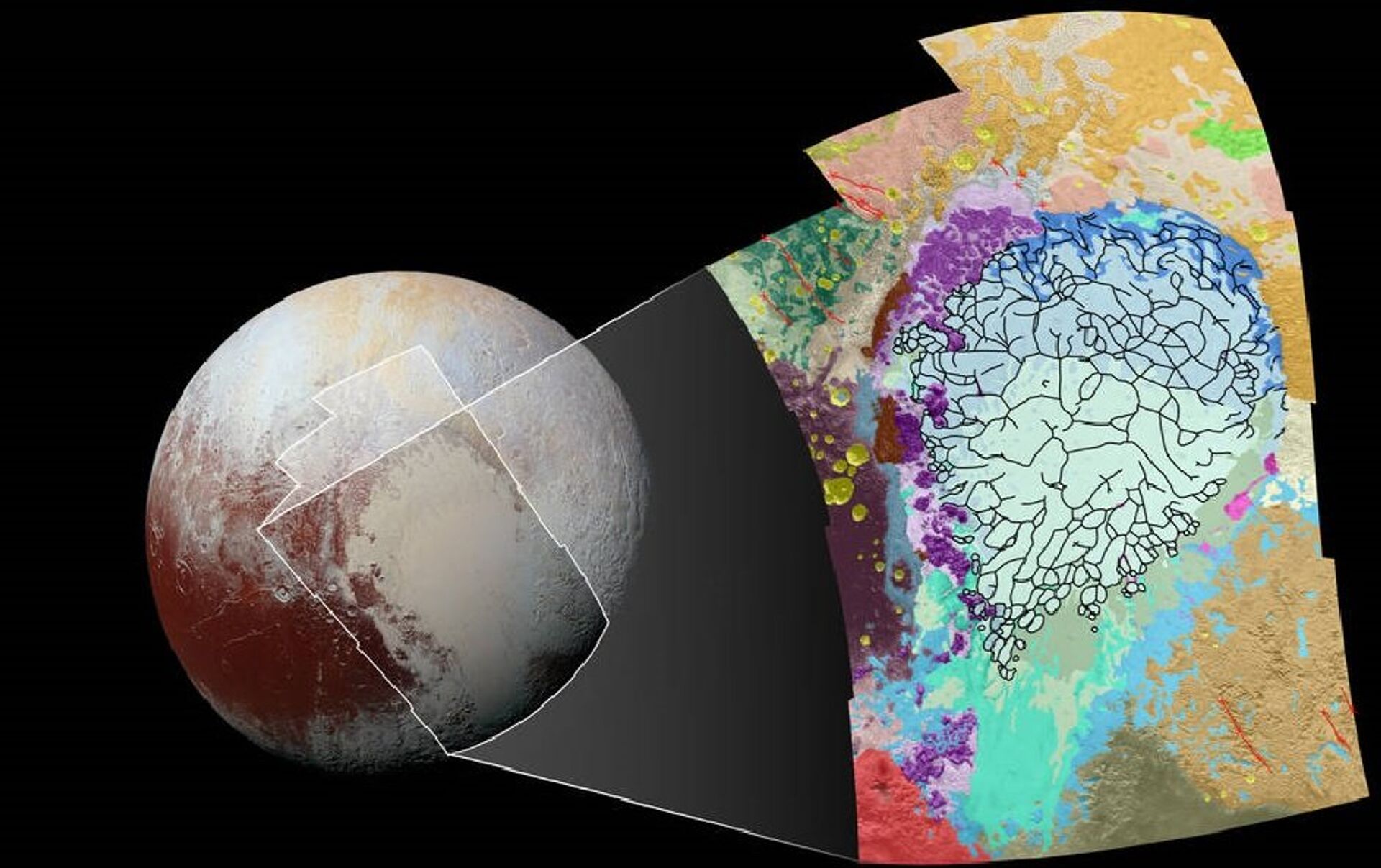
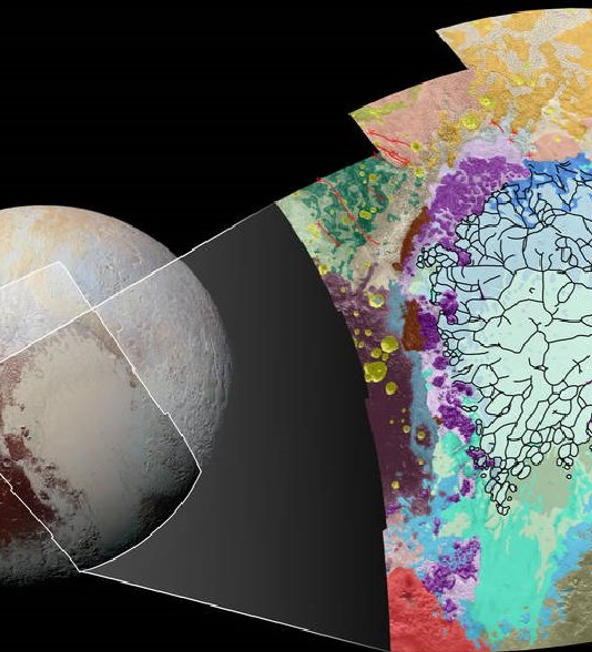
“This map covers a portion of Pluto’s surface that measures 1,290 miles (2,070 kilometers) from top to bottom,” a NASA press release said.
Each patch of color stands for a certain type of terrain, different in their geological morphology – uplands, plateaus, smooth lowlands, etc.
“Producing such maps is important in gauging what processes have operated where on Pluto, and when they occurred relative to other processes at work,” NASA stated.
In July 2015, NASA New Horizons space probe came within 12,500 kilometers of Pluto, becoming the first spacecraft to explore the dwarf planet.
In October, NASA said that an analysis of the data transferred by New Horizons revealed that Pluto has blue atmospheric hazes and numerous small exposed regions of ice water on its surface.

