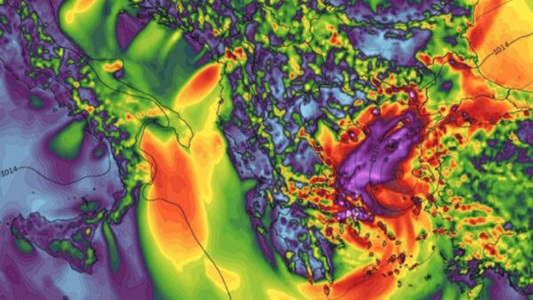
Generally weaker than a classic hurricane but no less capable of widespread destruction, the current Medicane Zorba has lashed many populated areas in Greece with heavy wind and rain, resulting in widespread flooding over the weekend.
— severe-weather.EU (@severeweatherEU) September 30, 2018
Gusts up to 55 mph were measured on Strofades earlier while sustained winds of 46 mph were clocked at Rodos, according to Wunderground.com.
Waterspouts and tornado warnings have been in effect throughout the northeastern portions of the slow-moving storm.
At Voutsaras, in the southern area of Greece, more than four inches of rain was recorded over several hours with gusty winds peaking at 65 mph.
— severe-weather.EU (@severeweatherEU) September 30, 2018
Barometric pressure readings near the center of the storm fell to 989.3 mb in Kalamata on Saturday.
European Storm Forecast Experiment Estofex noted that flash floods and landslides could be expected, particularly as rainfall amounts in normally dry areas could top 11 inches.
Weakening slightly after crossing the Greece landmass, Zorba is expected to again strengthen as it passes over warmer waters of the Aegean Sea, moving ENE to strike the western coast of Turkey in the early hours of Monday morning, bringing heavy rains and a continued flood risk, according to Severe Weather Europe.


