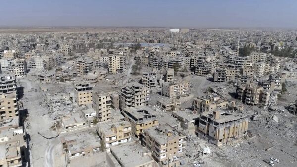
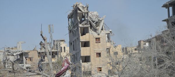
"Thousands of digital activists around the world will take part in an innovative new crowdsourcing data project Amnesty International is launching today, which uses satellite imagery to help plot how the US-led military coalition’s bombings destroyed almost 80% of the Syrian city of Raqqa. 'Strike Tracker' is the next phase of an in-depth Amnesty International investigation into the shocking scale of civilian casualties resulting from four months of US, UK and French bombardment to oust the armed group calling itself Daesh* from Raqqa," Amnesty International said in a press release.
According to the press release, the organization's field investigations have revealed that the actions of the US-led coalition in Raqqa constitute a violation of the international humanitarian law.
"With thousands of ‘Strike Trackers’ on the case to help us narrow down precisely when and where Coalition air and artillery strikes destroyed buildings, we can significantly scale up our ability to map out the apocalyptic destruction in Raqqa," Milena Marin, a senior adviser for tactical research on Amnesty International’s Crisis Response team, was quoted as saying in the press release.
READ MORE: Over 4,500 Artifacts From Raqqa Museum Stolen by Terrorists — Syrian Official
The city of Raqqa first fell into the hands of the Syrian opposition forces in 2013 and was then captured by Daesh, which proclaimed the city its de facto capital. In 2016, the Kurdish-led Syrian Democratic Forces (SDF), backed by the US-led coalition, launched a campaign to win the city back from the terrorists. The operation culminated in the 2017 Battle of Raqqa, which eventually allowed the SDF to gain control over the city.
*Daesh (also known as ISIS/ISIL/IS) is a terrorist group banned in Russia


