According to NASA, a tropical depression forms “when a low pressure area https://www.gisd.org/is accompanied by thunderstorms that produce a circular wind flow with maximum sustained winds below 39 mph.” A tropical depression is upgraded to a tropical storm when “cyclonic circulation becomes more organized and maximum sustained winds gust between 39 mph and 73 mph.”
— Dakota Smith (@weatherdak) September 18, 2019
— Mark Mulligan (@mrkmully) September 18, 2019
According to the Weather Channel, Imelda is currently moving “northward through eastern Texas.”
— NWS Houston (@NWSHouston) September 18, 2019
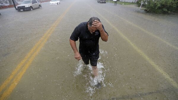
Several Texan counties, namely Brazoria, Galveston, Harris and Matagorda, have already received a total of 9 inches of rain as of Wednesday. The Texas city of Freeport has already received 15 inches of rain.
— Emily Evans (@Emily_Evans_M) September 18, 2019
— factsmichael (@factsmichael1) September 18, 2019
Six to 12 inches of rain are expected to cover southeastern Texas by the end of the week. As Imelda continues to crawl northward during the next few days, inland eastern Texas can expect to see between two and five inches of rain.
— ((( Aaron R 🚀 🦠 ))) (@aregberg) September 18, 2019
Several rescue teams in southeast Texas are already bracing for Imelda, according to KTNV, while several Texas schools in the Houston-Galveston area were closed Wednesday.
— Cesar Martinez (@cman3636) September 18, 2019
"The combination of pre-dawn rain and high tide indicate a probable safety issue for students and staff. Safe travel to and from Galveston ISD [Independent School District] is a primary concern," the Galveston Independent School District said in a statement.
— Roy Bright (@CulinaryGeekRoy) September 17, 2019
Portions of the upper Texas coast, including Houston and Galveston, as well as parts of southwestern Louisiana, are under flash flood watches.
According to a Thursday report by the National Weather Service (NWS), flash flooding is a “very dangerous situation.” The report also warns residents to be especially cautious at night, “when it is harder to recognize the dangers of floods and flash floods.”
— Cesar Martinez (@cman3636) September 18, 2019
“If flash flooding is observed … act quickly. Move up to escape flood waters. Do not stay in areas subject to flooding when water begins rising,” the NWS warns.
— sabrina (@justsabr1na) September 18, 2019
Imelda is just one of several storms currently brewing. Category 3 Hurricane Humberto is currently in the Atlantic Ocean and expected to pass close to Bermuda Wednesday night while Tropical Storm Jerry, which is currently east of the Leeward Islands in the northeastern Caribbean Sea, is expected to turn into a hurricane Thursday night.
Tropical Storms Lorena and Mario off the Mexican coast are also expected to become hurricanes. Tropical Storm Kiko is currently lurking in the Pacific Ocean, about 1,000 miles from Baja, California.

