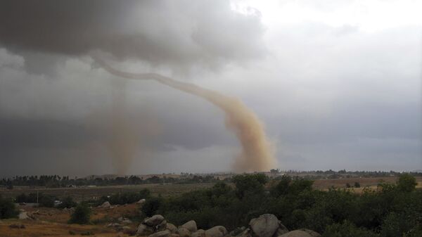
Environment Canada warned that large parts of eastern and central Ontario could face strong storms, thunderstorms and rainfall on Sunday, noting that they could be capable of producing tornadoes.
One such storm, located near Moulton Lake in South Frontenac, is moving northeast at 9 km/h, the agency said. A line of severe thunderstorms capable of producing tornadoes was located 7 kilometres northwest of Pakenham to Garretton, moving northeast at 5 km/h.
Tornado warnings have been issued for areas including Brockville, Burk's Falls, Cornwall, Smith's Falls and the city of Ottawa, with the north and south parts of the capital facing the possibility of tornadoes with potentially damaging wind gusts of up to 100 km/h.
"At 4:30 p.m. EDT [8:40 p.m. GMT], Environment Canada meteorologists are tracking a severe thunderstorm that is possibly producing a tornado. Damaging winds, large hail and locally intense rainfall are also possible", the agency said.
@environmentca has issued a #TornadoWarning for the city of #Ottawa, the capital of #Canada. If you live in the path of this storm, take shelter immediately. This is a radar indicated warning. #ONStorm #Weather #Tornado #WxTwitter pic.twitter.com/znfHPkYOYL
— Modeling and Climatology (@AndClimatology) August 2, 2020
Environment Canada warned that "persons in these areas should be on the lookout for threatening weather conditions and listen for possible warnings". The agency warned that in case of a tornado one should go indoors to a room on the lowest floor, away from outside walls and windows, such as a basement, bathroom, stairwell or interior closet and "leave mobile homes, vehicles, tents, trailers and other temporary or free-standing shelter, and move to a strong building if you can".
A photo of some clouds allegedly near Ottawa that could possibly "spawn a tornado" was shared in social media.
just spotted funnel clouds that could spawn a tornado outside ottawa, ontario on my way home #tornadowatch #ONStorm pic.twitter.com/IN5PIrkLLa
— jl (@jlb8r) August 2, 2020


