https://sputnikglobe.com/20211023/49-magnitude-eartquake-shakes-la-palma-as-spanish-island-territory-reels-from-volcano-eruption-1090162582.html
5.0 Magnitude Earthquake Shakes La Palma as Spanish Island Territory Reels From Volcano Eruption
5.0 Magnitude Earthquake Shakes La Palma as Spanish Island Territory Reels From Volcano Eruption
Sputnik International
Over 7,500 residents of the most northwesterly of Spain’s Canary Islands have been forced to flee their homes, with nearly 2,000 buildings damaged after the... 23.10.2021, Sputnik International
2021-10-23T19:03+0000
2021-10-23T19:03+0000
2021-10-23T19:15+0000
volcano
earthquake
https://cdn1.img.sputnikglobe.com/img/07e5/09/1d/1089500853_0:147:3118:1901_1920x0_80_0_0_d26a071a529e555e5f08f160ff486e72.jpg
Spain’s National Institute of Geography recorded a 5.0 earthquake near La Palma island on Saturday, with the moderate quake felt by island villages between 7 and 25 km from the epicenter. The temblor is thought to not have caused new damage on top of that already inflicted on the disaster-hit territory.The quake was caught live on-air by a correspondent from Spain’s 24 Horas news channel, who briefly screamed in terror as the ground shook beneath her.The quake is reported to have taken place at a moderate depth of between 38 and 44 km, and is the largest tremor of its kind since the seismic swarm that preceded the eruption of the Cumbre Vieja volcano. Dozens of smaller quakes were reported by the National Institute of Geography earlier in the day, with those quakes’ reported magnitudes reaching 3.9 on the Richter Scale.The Spanish government on Saturday promised to speed assistance to La Palma’s devastated agriculture and fishing industries, with new evacuations starting Thursday as lava spread to the coastal town of Tazcorte, forcing 500 people to flee their homes.The Cumbre Vieja began its most recent series of eruptions over a month ago, causing tens of millions of euros in damage and forcing the evacuation of thousands of residents. The lava flow has covered over 670 hectares of territory, with the molten rock expanding over a kilometer wide and heading toward the sea – destroying buildings, cutting through the coastal highway and creating a new peninsula on the western half of the island. The eruption is the largest of its kind since 1971. The Canary Islands were most recently affected by an eruption of a submarine volcano off the island of El Hierro – the smallest and southwestern-most of the formation, in 2012.
Sputnik International
feedback@sputniknews.com
+74956456601
MIA „Rossiya Segodnya“
2021
News
en_EN
Sputnik International
feedback@sputniknews.com
+74956456601
MIA „Rossiya Segodnya“
Sputnik International
feedback@sputniknews.com
+74956456601
MIA „Rossiya Segodnya“
volcano, earthquake
5.0 Magnitude Earthquake Shakes La Palma as Spanish Island Territory Reels From Volcano Eruption
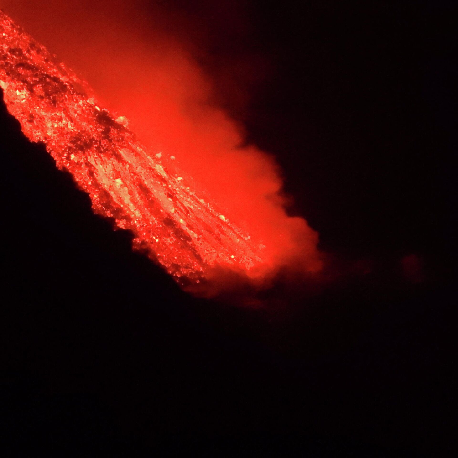
19:03 GMT 23.10.2021 (Updated: 19:15 GMT 23.10.2021) Over 7,500 residents of the most northwesterly of Spain’s Canary Islands have been forced to flee their homes, with nearly 2,000 buildings damaged after the Cumbre Vieja volcano erupted on 19 September. The eruption has been accompanied by continuing earthquakes of low to moderate intensity.
Spain’s National Institute of Geography
recorded a 5.0 earthquake near La Palma island on Saturday, with the moderate quake felt by island villages between 7 and 25 km from the epicenter. The temblor is thought to not have caused new damage on top of that already inflicted on the disaster-hit territory.
The quake was caught live on-air by a correspondent from Spain’s 24 Horas news channel, who briefly screamed in terror as the ground shook beneath her.
The quake is reported to have taken place at a moderate depth of between 38 and 44 km, and is the largest tremor of its kind since the seismic swarm that preceded the eruption of the Cumbre Vieja volcano.
Dozens of smaller quakes were reported by the National Institute of Geography earlier in the day, with those quakes’ reported magnitudes reaching 3.9 on the Richter Scale.
The Spanish government on Saturday promised to speed assistance to La Palma’s devastated agriculture and fishing industries, with new evacuations starting Thursday as lava spread to the coastal town of Tazcorte, forcing 500 people to flee their homes.
The Cumbre Vieja began its most recent series of eruptions over a month ago, causing tens of millions of euros in damage and forcing the evacuation of thousands of residents. The lava flow has covered over 670 hectares of territory, with the molten rock expanding over a kilometer wide and heading toward the sea – destroying buildings, cutting through the coastal highway and creating a new peninsula on the western half of the island. The eruption is the largest of its kind since 1971. The Canary Islands were most recently affected by an eruption of a submarine volcano off the island of El Hierro – the smallest and southwestern-most of the formation, in 2012.


