https://sputnikglobe.com/20211109/indian-army-looks-at-runway-independent-tactical-drones-to-sharpen-offensive-operations-1090586900.html
Indian Army Looks at Runway Independent Tactical Drones to Sharpen Offensive Operations
Indian Army Looks at Runway Independent Tactical Drones to Sharpen Offensive Operations
Sputnik International
India has been thinking how to limit its vulnerability along its border with China after a decades-old border dispute escalated into a violent face-off in June... 09.11.2021, Sputnik International
2021-11-09T11:34+0000
2021-11-09T11:34+0000
2023-07-16T05:54+0000
tibet
ladakh standoff
china
indian army
people's liberation army (pla) navy
uav
https://cdn1.img.sputnikglobe.com/img/07e5/0b/09/1090590565_0:250:3071:1978_1920x0_80_0_0_f0f5c6c766dfc9d1aca8550eeb0df2e5.jpg
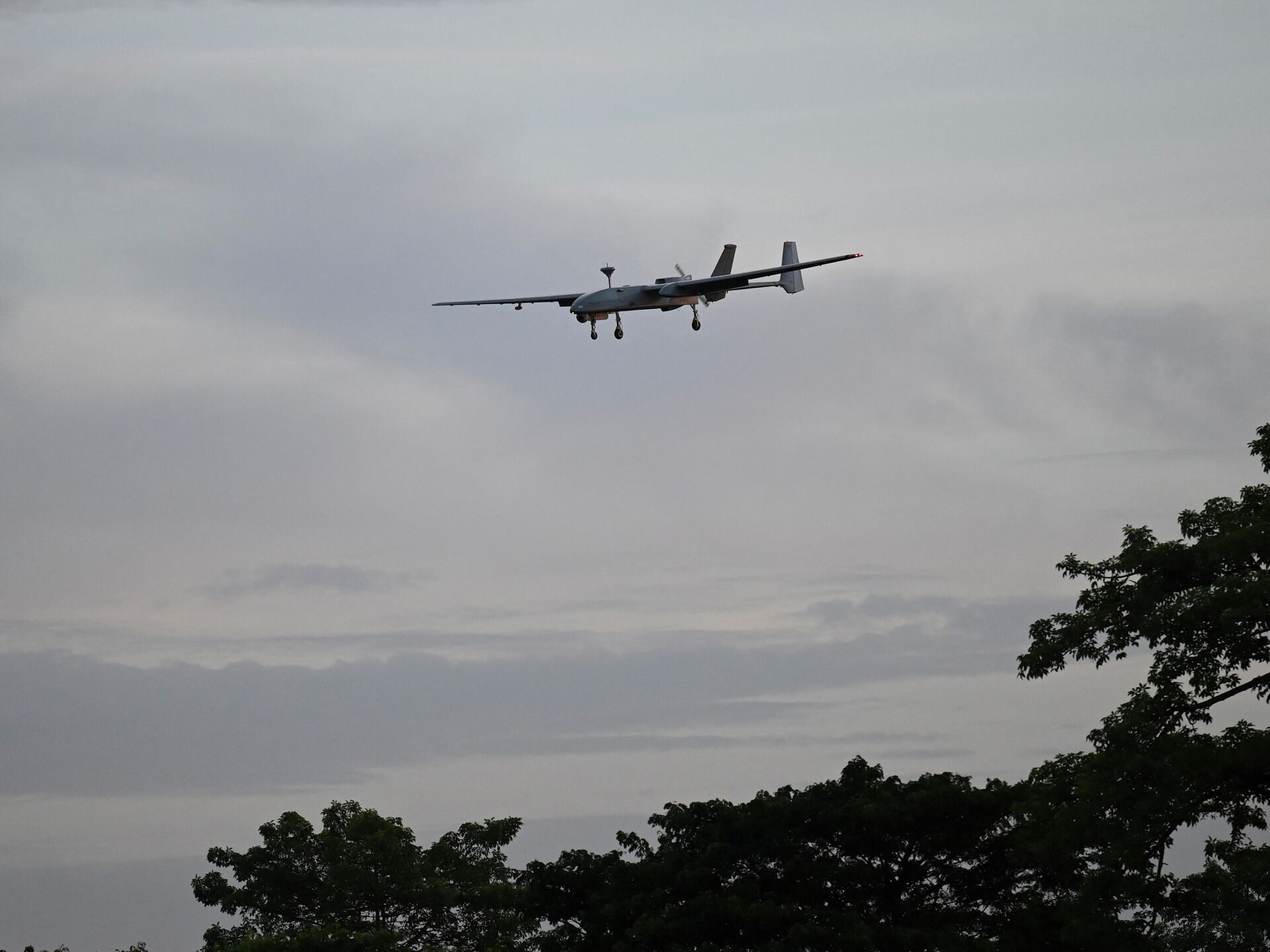
The Indian Army has sought to equip itself with modern battlefield runway independent drones to detect and respond to threats along the border with China to avoid the need to develop infrastructure in the treacherous terrain.Ground-based sensors have limited surveillance depth. The Army said that to mitigate the aerial threat; there is a need to maintain a high degree of operational readiness.The Army wants the automatic vertical take-off and landing system that has a range up to 100km and is critical for surveillance, target acquisition, direction of one's own artillery fire, and post-strike damage assessment.Since the terrain on the Chinese border provides easy access to enemy aircraft, helicopters, and UAVs flying at small altitudes, the Army wants round-the-clock surveillance of the region with high definition, and infra-red gimbal camera which are able to generate, detect and identify hostile targets up to 20km away from the drone.India and China share a 3,488km loosely demarcated border which mainly consists mainly of mountainous terrain. The decades-long border dispute witnessed a bloody face-off in June last year in the western sector of the Line of Actual Control, when 20 Indian soldiers and four Chinese troops were killed. Since last year, the two armies have intensified development of new infrastructure to sustain the large-scale deployment in the area.
https://sputnikglobe.com/20211012/deployment-of-s-400-by-china-at-ladakh-border-a-grave-threat-for-india-warns-opposition-1089868359.html
tibet
ladakh standoff
china
Sputnik International
feedback@sputniknews.com
+74956456601
MIA „Rossiya Segodnya“
2021
Rishikesh Kumar
https://cdn1.img.sputnikglobe.com/img/07e4/08/04/1080055820_0:0:388:389_100x100_80_0_0_40018ee210946d65d49ffba4f4c008e1.jpg
Rishikesh Kumar
https://cdn1.img.sputnikglobe.com/img/07e4/08/04/1080055820_0:0:388:389_100x100_80_0_0_40018ee210946d65d49ffba4f4c008e1.jpg
News
en_EN
Sputnik International
feedback@sputniknews.com
+74956456601
MIA „Rossiya Segodnya“
Sputnik International
feedback@sputniknews.com
+74956456601
MIA „Rossiya Segodnya“
Rishikesh Kumar
https://cdn1.img.sputnikglobe.com/img/07e4/08/04/1080055820_0:0:388:389_100x100_80_0_0_40018ee210946d65d49ffba4f4c008e1.jpg
tibet, ladakh standoff, china, indian army, people's liberation army (pla) navy, uav
tibet, ladakh standoff, china, indian army, people's liberation army (pla) navy, uav
Indian Army Looks at Runway Independent Tactical Drones to Sharpen Offensive Operations
11:34 GMT 09.11.2021 (Updated: 05:54 GMT 16.07.2023) India has been thinking how to limit its vulnerability along its border with China after a decades-old border dispute escalated into a violent face-off in June last year. China's People's Liberation Army (PLA) has also equipped its soldiers with mobile oxygen tanks and other military equipment to meet any eventuality.
The Indian Army has sought to equip itself with modern battlefield runway independent drones to detect and respond to threats along the border with China to avoid the need to develop infrastructure in the treacherous terrain.
Ground-based sensors have limited surveillance depth. The Army said that to mitigate the aerial threat; there is a need to maintain a high degree of operational readiness.
"It is ideal for mobile operations, reducing fixed-wing launch and recovery challenges while freeing troops from stationary runway constraints. It will provide a faster, shorter, and responsive sensor," an army document released by the Indian Army chief, General Manoj Mukund Naravane read.
The Army wants the
automatic vertical take-off and landing system that has a range up to 100km and is critical for surveillance, target acquisition, direction of one's own artillery fire, and post-strike damage assessment.

12 October 2021, 16:40 GMT
Since the terrain on the Chinese border provides easy access to enemy aircraft, helicopters, and UAVs flying at small altitudes, the Army wants
round-the-clock surveillance of the region with high definition, and infra-red gimbal camera which are able to generate, detect and identify hostile targets up to 20km away from the drone.
India and China share a 3,488km loosely demarcated border which mainly consists mainly of mountainous terrain. The decades-long border dispute witnessed a bloody face-off in June last year in the western sector of the Line of Actual Control, when 20 Indian soldiers and four Chinese troops were killed. Since last year, the two armies have intensified development of new infrastructure to sustain the large-scale deployment in the area.


