https://sputnikglobe.com/20220312/videos-late-winter-storm-slams-us-east-coast-with-strong-winds--inches-of-snow--1093816019.html
Videos: Late Winter Storm Slams US East Coast With Strong Winds & Inches of Snow
Videos: Late Winter Storm Slams US East Coast With Strong Winds & Inches of Snow
Sputnik International
Earlier, the US National Weather Service issued Winter Storm Warnings, Winter Storm Watches, and Winter Weather Advisories. The worst driving conditions are... 12.03.2022, Sputnik International
2022-03-12T22:13+0000
2022-03-12T22:13+0000
2023-04-14T12:56+0000
us
snowstorm
east
washington dc
weather
x (formerly twitter)
https://cdn1.img.sputnikglobe.com/img/07e6/03/0c/1093816392_0:0:2957:1663_1920x0_80_0_0_2a1bf53f34784b5b2c5c6e3ccae5bff5.jpg
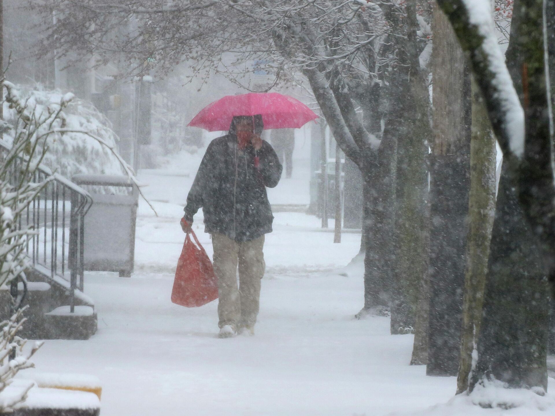
A strong storm system is sweeping the US East Coast, bringing rain, snow, wind, and isolated episodes of more severe weather. According to US media reports, on Saturday, tornado watches were issued for areas of the Carolina Coastal Plain, with blizzard warnings reportedly issued for the first time since 2016. Over Friday night, the same parent storm system dumped snow on the Mid-South, with Arkansas reporting the rare thundersnow. The system will reach the eastern coast of Canada, with strong wind gusts, as it develops into a powerful low with air pressure comparable to Hurricane Sandy in 2012.Temperatures are reported to be dropping into the 20- and 30-degrees Fahrenheit (below zero degrees Celsius) behind the system, which is carrying a strong cold front eastward. Freeze warnings have been issued for a majority of the Gulf Coast, from Florida to Texas and Louisiana. Next week, a warmer trend is forecast.According to meteorologists, "bomb cyclone" is a term used to describe a low-pressure system that experiences "bombogenesis," defined as a rapid pressure decrease of at least 24 millibars in less than 24 hours, suggestive of a powerful storm system. The stronger the winds are, the lower the barometric pressure.Social media has been flooded with videos of East Coasters commenting that it is again beginning to look like... well, not Spring, that is certain.Strong wind gusts in Florida caused a waterspout to appear at Fort Myers Beach, according to eyewitnesses.According to the reports, north-central Pennsylvania and especially east central and northern New York state are likely to get a few more centimeters of snow, with one or two areas in the northern sections getting 13 to 17 centimeters (5 to 7 inches). Northern Vermont might see 10 to 15 centimeters (4 to 6 inches) of snowfall. Northern New Hampshire and western Maine should reportedly expect 13 to 17 centimeters (5 to 7 inches) of snow, with up to 25 centimeters (10 inches) in northern Aroostook County, with the majority of the precipitation falling during the afternoon hours.The "bomb cyclone" was anticipated to dump snow in at least 22 states, with a growing likelihood of wintry precipitation along Interstate 95 in the Mid-Atlantic and Northeast.As the storm progresses into eastern Canada, the snow is expected to end from west to east on Saturday night, but sloppy roads may continue into Sunday morning across the Northeast due to below-freezing temperatures.Let's stay in touch no matter what! Follow our Telegram channel to get all the latest news: https://t.me/sputniknewsus
east
washington dc
Sputnik International
feedback@sputniknews.com
+74956456601
MIA „Rossiya Segodnya“
2022
News
en_EN
Sputnik International
feedback@sputniknews.com
+74956456601
MIA „Rossiya Segodnya“
Sputnik International
feedback@sputniknews.com
+74956456601
MIA „Rossiya Segodnya“
us, snowstorm, east, washington dc, weather, x (formerly twitter)
us, snowstorm, east, washington dc, weather, x (formerly twitter)
Videos: Late Winter Storm Slams US East Coast With Strong Winds & Inches of Snow
22:13 GMT 12.03.2022 (Updated: 12:56 GMT 14.04.2023) Kirill Kurevlev
Managing Editor
Earlier, the US National Weather Service issued Winter Storm Warnings, Winter Storm Watches, and Winter Weather Advisories. The worst driving conditions are expected in areas covered by the Winter Storm Warnings, however, hazardous travel is likely in any of the areas covered by the winter weather alerts.
A strong storm system is sweeping the US East Coast, bringing rain, snow, wind, and isolated episodes of more severe weather.
According to
US media reports, on Saturday, tornado watches were issued for areas of the Carolina Coastal Plain, with blizzard warnings reportedly issued for the first time since 2016. Over Friday night, the same parent storm system dumped snow on the Mid-South, with Arkansas reporting the rare thundersnow.
The system will reach the eastern coast of Canada, with strong wind gusts, as it develops into a powerful low with air pressure comparable to Hurricane Sandy in 2012.
Temperatures
are reported to be dropping into the 20- and 30-degrees Fahrenheit (below zero degrees Celsius) behind the system, which is carrying a strong cold front eastward. Freeze warnings have been issued for a majority of the Gulf Coast, from Florida to Texas and Louisiana.
Next week, a warmer trend is forecast.
According to meteorologists, "bomb cyclone" is a term used to describe a low-pressure system that experiences "bombogenesis," defined as a rapid pressure decrease of at least 24 millibars in less than 24 hours, suggestive of a powerful storm system. The stronger the winds are, the lower the barometric pressure.
Social media has been flooded with videos of East Coasters commenting that it is again beginning to look like... well, not Spring, that is certain.
Strong wind gusts in Florida caused a waterspout to appear at Fort Myers Beach, according to eyewitnesses.
According to the reports, north-central Pennsylvania and especially east central and northern New York state are likely to get a few more centimeters of snow, with one or two areas in the northern sections getting 13 to 17 centimeters (5 to 7 inches). Northern Vermont might see 10 to 15 centimeters (4 to 6 inches) of snowfall.
Northern New Hampshire and western Maine should reportedly expect 13 to 17 centimeters (5 to 7 inches) of snow, with up to 25 centimeters (10 inches) in northern Aroostook County, with the majority of the precipitation falling during the afternoon hours.
The "bomb cyclone"
was anticipated to dump snow in at least 22 states, with a growing likelihood of wintry precipitation along Interstate 95 in the Mid-Atlantic and Northeast.
As the storm progresses into eastern Canada, the snow is expected to end from west to east on Saturday night, but sloppy roads may continue into Sunday morning across the Northeast due to below-freezing temperatures.
Let's stay in touch no matter what! Follow our Telegram channel to get all the latest news: https://t.me/sputniknewsus 

