Antarctic Ice Shelf Crumbling Twice as Fast as Previously Estimated, Study Finds
04:00 GMT 12.08.2022 (Updated: 13:02 GMT 23.11.2022)

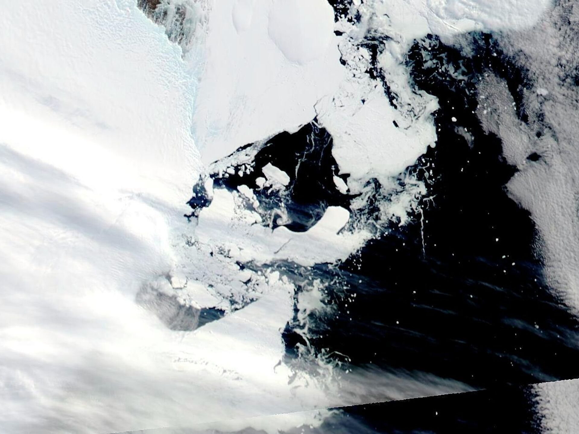
© AP Photo / Dr. Christopher A. Shuman, UMBC/NASA
Subscribe
It takes thousands of years for ice shelves, which are permanently floating sheets of frozen freshwater tied to land, to form. Once formed, they function as buttresses to hold back glaciers that would otherwise readily slip into the ocean, drastically raising sea levels, which would cause a global catastrophe.
A newly conducted satellite analysis revealed that the world's greatest ice sheet has lost twice as much ice over the past 25 years as previously thought because the coastal glaciers in Antarctica are losing icebergs faster than the environment can restore the melting ice, a research published in the journal Nature said.
The study, conducted by scientists at NASA's Jet Propulsion Laboratory (JPL), implies it is now more important than ever to be concerned about how quickly climate change is weakening Antarctica's floating ice shelves and accelerating the rise of the world's sea levels.
The main conclusion of the study was that the net loss of Antarctic ice from chunks of coastal glaciers "calving" off into the ocean is almost as great as the net loss of ice scientists already knew was occurring due to thinning brought on by the melting of ice shelves from below by warming seas.
The investigation found that thinning and calving, when combined, have decreased the bulk of Antarctica's ice shelves by 12 trillion tons since 1997, which is twice the prior estimate.

According to JPL scientist Chad Greene, the study's principal author, the continent's ice sheet has lost about 37,000 sq km (14,300 sq miles) of its total surface during the previous 25 years due to calving alone - an area almost the size of Switzerland.
"Antarctica is crumbling at its edges," Greene is quoted in the NASA's news release. "And when ice shelves dwindle and weaken, the continent's massive glaciers tend to speed up and increase the rate of global sea level rise."
 as the ice sheet melts by contact with ocean water; it rises (blue) where accumulation exceeds melting. Ice shelves are shown in gray. The missions that supplied data are listed at bottom.")
Changes in elevation of the Antarctic ice sheet from 1985 to 2021 are shown. Ice height diminishes (red) as the ice sheet melts by contact with ocean water; it rises (blue) where accumulation exceeds melting. Ice shelves are shown in gray. The missions that supplied data are listed at bottom.
© Photo : NASA/JPL-Caltech
The majority of Antarctic glaciers flow into the ocean, where they freeze into shelves of ice that can be up to 800 kilometers (500 miles) long and up to 3 kilometers (2 miles) thick.
Glaciers are supported by ice shelves, which prevent the ice from slipping into the ocean. When ice shelves are stable, calving and replenishment occur naturally as part of a cycle that maintains their size throughout time.
However, in recent decades, warmer oceans have damaged the shelves from below. This phenomena has already been observed by satellite altimeters, which track changes in the height of the ice. According to NASA, losses from 2002 to 2020 averaged 149 million tons per year.
There may be severe repercussions. According to the researchers, Antarctica is the birthplace of 88% of the world's ice, which has the potential to raise sea levels.
Greene and his co-authors used satellite images of the continent from 1997 in the visible, thermal infrared (heat), and radar wavelengths for the current study.
They documented the boundaries of ice shelves throughout 50,000 kilometers (30,000 linear miles) of Antarctic coastline by fusing these observations with knowledge of ice movement obtained from an ongoing NASA glacier mapping effort.
"For example,” said Greene, “you can imagine looking at a satellite image and trying to figure out the difference between a white iceberg, white ice shelf, white sea ice, and even a white cloud. That’s always been a difficult task. But we now have enough data from multiple satellite sensors to see a clear picture of how Antarctica’s coastline has evolved in recent years.”
The lab also produced a second, complementary study on the matter. Published in Earth System Science Data, it provides previously unheard-of levels of data on how Antarctic ice loss caused by ocean water melting has penetrated the continent's interior and nearly doubled its western portions over the previous ten years, according to the release.
To compile the longest continuous data collection on the changing height of the ice sheet - an indicator of ice loss - from as early as 1985, JPL scientists combined nearly 3 billion data points from seven spaceborne altimetry equipment.
The highest-resolution monthly maps of change ever recorded of ice loss were created using centimeter-accurate ice elevation data taken by radar and laser.
The new record's unmatched level of detail demonstrates how seasonal weather patterns and long-term trends influence the ice. As subglacial lakes continually fill and empty kilometers below the surface, it even depicts the rise and fall of the ice sheet, as seen in NASA's video.
“Subtle changes like these, in combination with improved understanding of long-term trends from this data set, will help researchers understand the processes that influence ice loss, leading to improved future estimates of sea level rise,” JPL’s Johan Nilsson, lead author of the study, said in a statement.
For instance, National Geographic emphasizes the significance of keeping an eye on sea level rise since it has the potential to worsen floods, storm surge severity, and damage to coastal towns.
This implies that not only wildlife but also densely populated areas will need to leave their current locations.


