
‘Scope of This Earthquake Is the Biggest in Turkiye’s History’, Turkish Seismologist Says
04:13 GMT 10.02.2023 (Updated: 06:03 GMT 10.02.2023)

© Sputnik
/ Subscribe
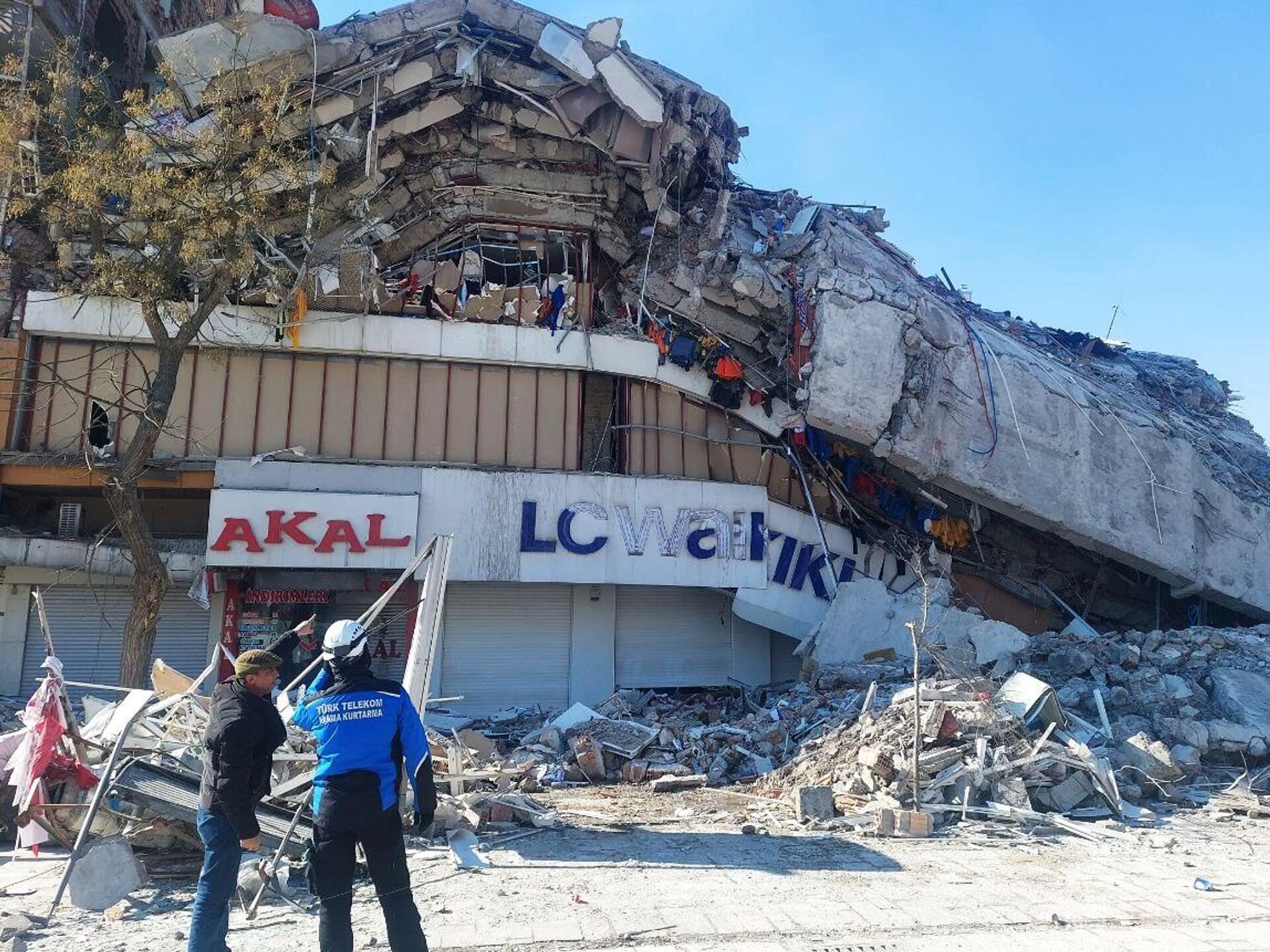
The death toll from the earthquake in Turkiye has exceeded 16,000, while the number of injured is more than 70,000, the country's President Recep Tayyip Erdogan recently said.
The 7.7-magnitude earthquake struck the province of Kahramanmaras in the early morning hours of February 6. As President Erdogan noted, it was the largest since 1939. Three dozen aftershocks followed, followed by another magnitude 7.6 earthquake in the middle of the day. Turkiye has been shaking for three days.

9 February 2023, 14:23 GMT
Professor Dogan Perincek, a Turkish seismologist, commented to Sputnik on the aftermath of the devastating tremors in Kahramanmaras.
"This is a great tragedy. The earthquake affected a very large area - 470 km (in diameter). For comparison, the length of the Sea of Marmara is about 250 km. This means that the area affected by the earthquake is almost twice as long. The aftershocks after the earthquake reached 6.6 points, which is almost the same as the main quake. In terms of magnitude, this is probably the first earthquake of its kind in Turkiye. We have experienced a number of earthquakes on tectonic faults. For example, the Erzincan earthquake had a magnitude of 7.9, but the area affected was much smaller," the professor said.
Why did the earthquake affect such a large area? According to the professor, the reason is that the epicenter of the earthquake was located at a point where two tectonic faults, the Dead Sea Rift and the East Anatolian Fault, converge. Kahramanmaras is located right next to this point. Thus, the earthquake occurred at the confluence of these two faults, which determined its destructive magnitude. This is an unusual situation.
“For the last 10 days I have been recording increased seismic activity in Canakkale from the Sea of Marmara side. For more than 10 years, I have been monitoring and analyzing the seismic activity in the country daily with special maps. For three years I have been predicting an earthquake in Canakkale (a port city on the coast of the Dardanelles). An earthquake in this area occurs about once every 250 years and has a magnitude of 7. The last time there was an earthquake was 287 years ago. The time has come, there could be tremors at any moment. My observations in the Sea of Marmara confirm this assumption.”

