https://sputnikglobe.com/20210930/nothing-to-see-here-former-french-nuclear-weapon-test-site-partially-blurred-on-google-map-1089548029.html
Nothing to See Here: Former French Nuclear Weapon Test Site Partially Blurred on Google Map
Nothing to See Here: Former French Nuclear Weapon Test Site Partially Blurred on Google Map
Sputnik International
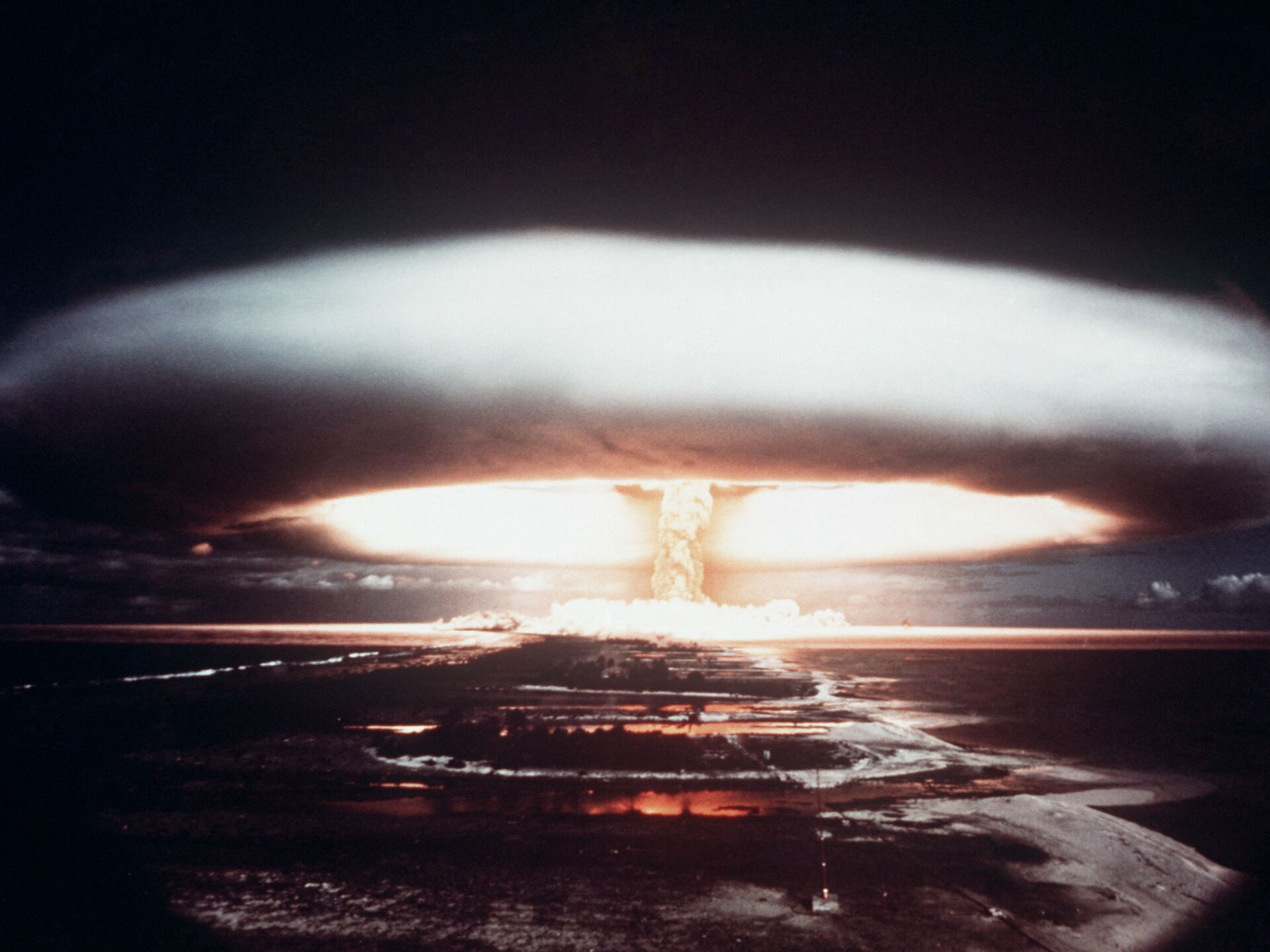
Nuclear weapon tests were conducted by the French government at the Mururoa atoll between 1966 and 1996. 30.09.2021, Sputnik International
2021-09-30T12:15+0000
2021-09-30T12:15+0000
2025-04-07T10:58+0000
map
site
french polynesia
nuclear weapons
viral news
https://cdn1.img.sputnikglobe.com/img/07e5/03/09/1082290535_0:293:3015:1989_1920x0_80_0_0_b5754ba147fba9a028ade05c348e45a9.jpg
The image of an atoll in French Polynesia, which was used by France as a nuclear test site during the second half of the 20th century, is partially blurred on Google Earth.While the left side of the Mururoa atoll is visible, of the right side only the outline can be seen, with the rest being obscured by blur.While the Daily Mirror notes that it is unclear why exactly this particular part of Google’s digital map is the way it is, the newspaper suggests that it may be related to the French military presence in the area, meant to safeguard the site.The French government conducted nuclear weapons tests at Mururoa from 1966 until 1996, in spite of international protests sparked by these detonations.
french polynesia
Sputnik International
feedback@sputniknews.com
+74956456601
MIA „Rossiya Segodnya“
2021
News
en_EN
Sputnik International
feedback@sputniknews.com
+74956456601
MIA „Rossiya Segodnya“
Sputnik International
feedback@sputniknews.com
+74956456601
MIA „Rossiya Segodnya“
map, site, french polynesia, nuclear weapons, viral news
map, site, french polynesia, nuclear weapons, viral news
Nothing to See Here: Former French Nuclear Weapon Test Site Partially Blurred on Google Map
12:15 GMT 30.09.2021 (Updated: 10:58 GMT 07.04.2025) Nuclear weapon tests were conducted by the French government at the Mururoa atoll between 1966 and 1996.
The image of an atoll in French Polynesia, which was used by France as a nuclear test site during the second half of the 20th century, is partially blurred on Google Earth.
While the left side of the Mururoa atoll is visible, of the right side only the outline can be seen, with the rest being obscured by blur.
While the Daily Mirror notes that it is unclear why exactly this particular part of Google’s digital map is the way it is, the newspaper suggests that it may be related to the French military presence in the area, meant to safeguard the site.
The French government conducted nuclear weapons tests at Mururoa from 1966 until 1996, in spite of international protests sparked by these detonations.


