https://sputnikglobe.com/20230816/china-launches-ludi-tance-4-first-geosynchronous-radar-satellite-able-to-map-one-third-of-earth-1112654286.html
China Launches Ludi Tance-4, First Geosynchronous Radar Satellite Able to Map One-Third of Earth
China Launches Ludi Tance-4, First Geosynchronous Radar Satellite Able to Map One-Third of Earth
Sputnik International
China’s space program has rocketed upward in recent years, dramatically expanding its network of high-tech satellites and sending probes to the moon and Mars. Recently, Beijing unveiled plans for a manned lunar base.
2023-08-16T19:40+0000
2023-08-16T19:40+0000
2023-08-16T19:39+0000
beyond politics
xichang satellite launch center
china
satellite
radar
geosynchronous earth orbit
https://cdn1.img.sputnikglobe.com/img/07e7/08/10/1112654128_0:19:1510:868_1920x0_80_0_0_a256f941eafe23b0cd5d984594f5a7e8.png
Early Saturday, a Long March 3B rocket blasted off from the Xichang Satellite Launch Center in China’s Sichuan Province carrying the Land Exploration-4 01 (Ludi Tance-4 (01)) satellite.The orbital device is a first: it will sit in a geosynchronous Earth orbit and use an L-band synthetic aperture radar (SAR) to monitor up to one-third of the planet at once.Even though a geosynchronous orbit is among the highest occupied by satellites, at some 22,370 miles (36,000 kilometers) above the Earth’s surface, the satellite will be able to monitor the entire-Asia-Pacific region to a resolution of about 65 feet (20 meters).Last year, China launched two other Ludi Tance satellites at much lower orbits of just 372 miles (600 kilometers) to monitor landslides, earthquakes and other geological phenomena.The radar has significant advantages over traditional photography in that it can penetrate any kind of weather. China’s High-resolution Earth Observation System (CHEOS) satellites, which are also geosynchronous, suffer from this limitation, despite having higher resolution on clear days.Stephen Hobbs, a professor in space systems and sensors from Cranfield University in England, told US media the satellite’s resolution “is actually quite good for geosynchronous radar.”“The main advantage of the geosynchronous orbit is the permanent view of Earth over continental scales – about 30 % of the Earth’s surface – so that rapid repeat viewing of a particular area with a single satellite is possible,” the expert added.
https://sputnikglobe.com/20230810/chinese-commercial-rocket-ceres-1-sends-7-satellites-into-orbit-1112506077.html
china
Sputnik International
feedback@sputniknews.com
+74956456601
MIA „Rossiya Segodnya“
2023
News
en_EN
Sputnik International
feedback@sputniknews.com
+74956456601
MIA „Rossiya Segodnya“
Sputnik International
feedback@sputniknews.com
+74956456601
MIA „Rossiya Segodnya“
ludi tance; chinese satellite; geosynchronous orbit
ludi tance; chinese satellite; geosynchronous orbit
China Launches Ludi Tance-4, First Geosynchronous Radar Satellite Able to Map One-Third of Earth
China’s space program has rocketed upward in recent years, dramatically expanding its network of high-tech satellites and sending probes to the moon and Mars. Recently, Beijing unveiled plans for a manned lunar base in the next decade.
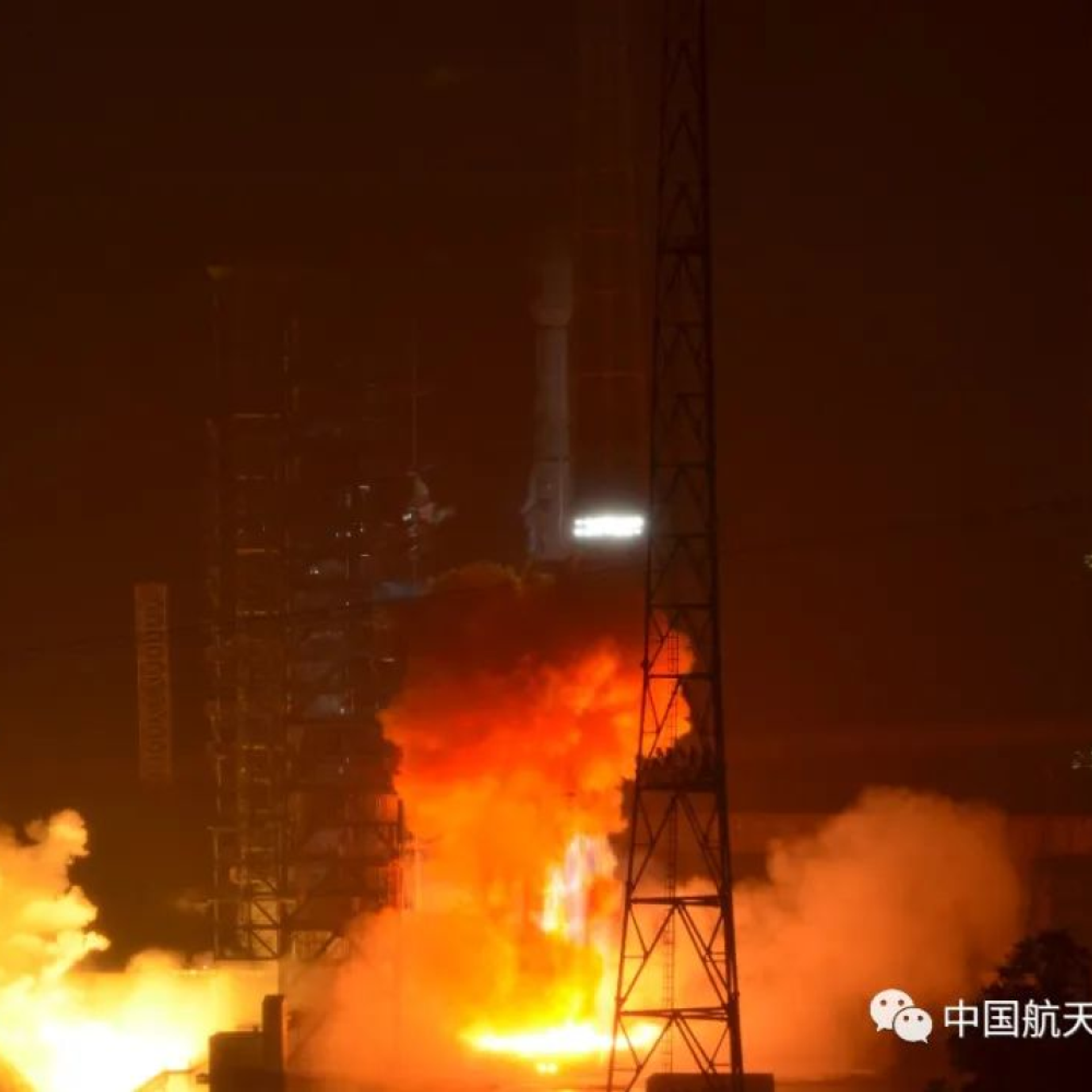
Early Saturday, a Long March 3B rocket blasted off from the Xichang Satellite Launch Center in China’s Sichuan Province carrying the Land Exploration-4 01 (Ludi Tance-4 (01)) satellite.
The orbital device is a first: it will sit in a geosynchronous Earth orbit and use an L-band synthetic aperture radar (SAR) to monitor up to one-third of the planet at once.
According to the China Aerospace Science and Technology Corporation (CASC), the Ludi Tance-4 “was developed by the Fifth Academy of China Aerospace Science and Technology Corporation to meet the application needs of disaster prevention and reduction, earthquake monitoring, land and resources survey, ocean, water conservancy, meteorology, agriculture, environmental protection, forestry and other industries in my country and surrounding areas.”
Even though a geosynchronous orbit is among the highest occupied by satellites, at some 22,370 miles (36,000 kilometers) above the Earth’s surface, the satellite will be able to monitor the entire-Asia-Pacific region to a resolution of about 65 feet (20 meters).

10 August 2023, 10:19 GMT
Last year, China launched two other Ludi Tance satellites at much lower orbits of just 372 miles (600 kilometers) to monitor landslides, earthquakes and other geological phenomena.
The radar has significant advantages over traditional photography in that it can penetrate any kind of weather. China’s High-resolution Earth Observation System (CHEOS) satellites, which are also geosynchronous, suffer from this limitation, despite having higher resolution on clear days.
Stephen Hobbs, a professor in space systems and sensors from Cranfield University in England, told US media the satellite’s resolution “is actually quite good for geosynchronous radar.”
“It should be able to observe subtle, millimeter-level ground motions due to landslides and earthquakes, which is a powerful measurement capability,” he said.
“The main advantage of the geosynchronous orbit is the permanent view of Earth over continental scales – about 30 % of the Earth’s surface – so that rapid repeat viewing of a particular area with a single satellite is possible,” the expert added.


