https://sputnikglobe.com/20230817/us-military-releases-wwii-aerial-reconnaissance-snapshots-of-england-1112661245.html
US Military Releases WWII Aerial Reconnaissance Snapshots of England
US Military Releases WWII Aerial Reconnaissance Snapshots of England
Sputnik International
The reconnaissance units of the United States Army Air Forces (USAAF), the precursor to the US Air Force, were responsible for capturing over 3,600 black and white images.
2023-08-17T04:04+0000
2023-08-17T04:04+0000
2023-08-17T04:04+0000
beyond politics
us
england
us air force
historic england
reconnaissance
https://cdn1.img.sputnikglobe.com/img/07e7/08/11/1112661024_0:207:851:685_1920x0_80_0_0_b50438ee2cbc99ad7c93a978f7d106b4.png
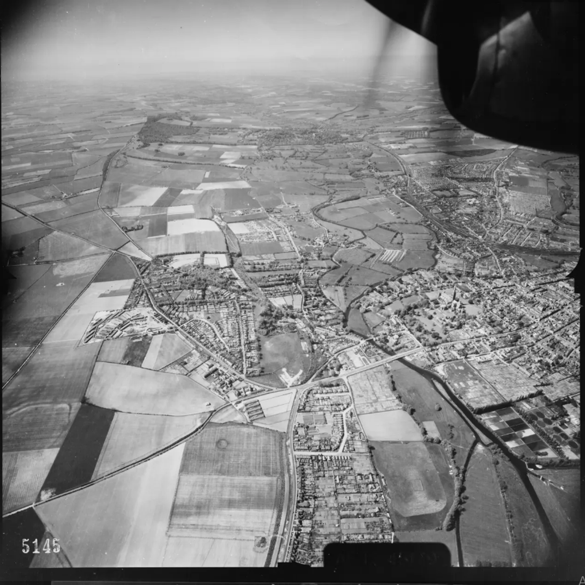
In a remarkable digital unveiling, the US military's aerial reconnaissance photographs of England during World War II have been made accessible online for the very first time. Prior to the era of Google Earth, the newly-released images provide an extraordinary window into the past, offering a bird's-eye view of the changing landscape of England from 1943 to 1944.The images were focused primarily around American bases situated in the southern region of England. The vast trove of historical visuals was recently made available through a free online map archive maintained by Historic England, an organization dedicated to preserving England's history and environment.The collection showcases a diverse range of subjects, from snapshots of US military personnel engaged in baseball games to images of ancient monuments protected by anti-tank defenses. Through these photographs, viewers are able to gain an insightful perspective into the war's impact on England, as well as the training required before embarking on bombing and reconnaissance missions across Nazi-occupied Europe.Notably, the compilation emphasizes the construction of new airfields by US forces, along with military camps and storage facilities established in preparation for the pivotal D-Day operation in June 1944. Additionally, towns and cities, including Manchester with its bomb-damaged Old Trafford stadium in 1941, have been documented in the collection.The images further offer a narrative of the US military's presence in England during World War II, beginning with their arrival in 1942. Following America's entry into the conflict after the attack on Pearl Harbor, pilots embarked on reconnaissance flights to familiarize themselves with local areas near their bases.The aircraft used in these missions underwent modifications, including the removal of weapons and the installation of fixed cameras and additional fuel tanks for extended voyages. With various lenses and focal lengths, these cameras captured vast regions with exceptional precision.
https://sputnikglobe.com/20230815/laser-mapping-unveils-hidden-secrets-of-wwii-battle-of-the-bulge-1112599500.html
england
Sputnik International
feedback@sputniknews.com
+74956456601
MIA „Rossiya Segodnya“
2023
News
en_EN
Sputnik International
feedback@sputniknews.com
+74956456601
MIA „Rossiya Segodnya“
Sputnik International
feedback@sputniknews.com
+74956456601
MIA „Rossiya Segodnya“
united states army air forces snapshots of england, usaaf trove of ww2 england photos, ww2 england landscape, us military release, how did england look back in ww2, what was wwii aerial reconnaissance like
united states army air forces snapshots of england, usaaf trove of ww2 england photos, ww2 england landscape, us military release, how did england look back in ww2, what was wwii aerial reconnaissance like
US Military Releases WWII Aerial Reconnaissance Snapshots of England
The reconnaissance units of the United States Army Air Forces (USAAF), the precursor to the US Air Force, were responsible for capturing over 3,600 black and white images.
In a remarkable digital unveiling, the US military's aerial reconnaissance photographs of England during World War II have been made accessible online for the very first time.
Prior to the era of Google Earth, the newly-released images provide an extraordinary window into the past, offering a bird's-eye view of the changing landscape of England from 1943 to 1944.
The images were focused primarily around American bases situated in the southern region of England. The vast trove of historical visuals was recently made available through a free online map archive maintained by Historic England, an organization dedicated to preserving England's history and environment.
"Our collection of USAAF wartime photographs were taken in England by the pilots and aircraft of squadrons that provided intelligence for the eventual defeat of Nazi Germany. This came at a cost, with many pilots killed in the line of duty," said Duncan Wilson, chief executive of Historic England.
The collection showcases a diverse range of subjects, from snapshots of US military personnel engaged in baseball games to images of ancient monuments protected by anti-tank defenses. Through these photographs, viewers are able to gain an insightful perspective into the war's impact on England, as well as the training required before embarking on bombing and reconnaissance missions across Nazi-occupied Europe.

15 August 2023, 03:58 GMT
Notably, the compilation emphasizes the construction of new airfields by US forces, along with military camps and storage facilities established in preparation for the pivotal D-Day operation in June 1944. Additionally, towns and cities, including Manchester with its bomb-damaged Old Trafford stadium in 1941, have been documented in the collection.
"They help to highlight the vital role aerial reconnaissance played in the Second World War," said Wilson.
The images further offer a narrative of the US military's presence in England during World War II, beginning with their arrival in 1942. Following America's entry into the conflict after the attack on Pearl Harbor, pilots embarked on reconnaissance flights to familiarize themselves with local areas near their bases.
The aircraft used in these missions underwent modifications, including the removal of weapons and the installation of fixed cameras and additional fuel tanks for extended voyages. With various lenses and focal lengths, these cameras captured vast regions with exceptional precision.


